Category:Oakenshaw, Lancashire
Jump to navigation
Jump to search
English: Oakenshaw is a village in Lancashire, in England. It is situated between Clayton-le-Moors and Great Harwood.
area in Clayton-le-Moors, Lancashire, UK  | |||||
| Upload media | |||||
| Instance of | |||||
|---|---|---|---|---|---|
| Location | Clayton-le-Moors, Hyndburn, Lancashire, North West England, England | ||||
 | |||||
Media in category "Oakenshaw, Lancashire"
The following 19 files are in this category, out of 19 total.
-
 Barnes Street, Clayton-le-Moors - geograph.org.uk - 692347.jpg 640 × 480; 228 KB
-
 Bridge over Hyndburn Brook (geograph 1693775).jpg 2,816 × 2,112; 2.1 MB
-

-
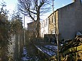
 Dismantled railway - geograph.org.uk - 1587652.jpg 640 × 480; 60 KB
-
 Forts Arms, Clayton-le-Moors - geograph.org.uk - 3370900.jpg 3,872 × 2,592; 3.47 MB
-

-
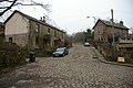
 Hindlefold Lane - geograph.org.uk - 1108906.jpg 640 × 480; 117 KB
-
 Hindlefold Lane - geograph.org.uk - 1108908.jpg 640 × 480; 103 KB
-
 Hygiene, Footpath - geograph.org.uk - 1150964.jpg 640 × 480; 110 KB
-
 Hyndburn Bridge - geograph.org.uk - 3370839.jpg 3,872 × 2,592; 6.44 MB
-
 Open space - geograph.org.uk - 757499.jpg 640 × 480; 240 KB
-
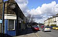
 Park Lane, Great Harwood - geograph.org.uk - 1736397.jpg 640 × 480; 180 KB
-
 Police Station - geograph.org.uk - 1599156.jpg 640 × 480; 69 KB
-
 Police Station - geograph.org.uk - 1599159.jpg 640 × 480; 65 KB
-
-
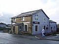 Royal Oak, Sparth Road, Clayton-le-Moors - geograph.org.uk - 658691.jpg 612 × 460; 143 KB
-

-
 Whalley Road - geograph.org.uk - 1199088.jpg 640 × 407; 67 KB
-
 Woodland near Hyndburn Brook - geograph.org.uk - 3370857.jpg 3,872 × 2,592; 6.96 MB

.jpg)


